Interactive Hiking Maps for WordPress
Turn your list of summits, trails, and viewpoints into a beautiful, interactive map — no coding required.
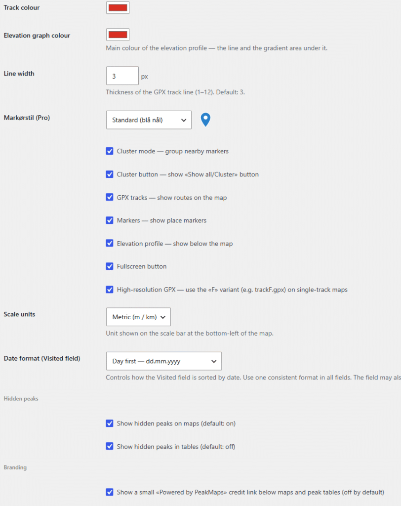
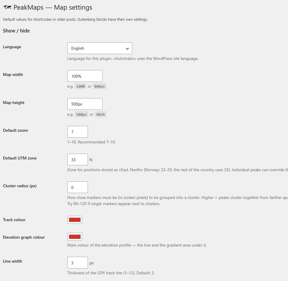
PeakMaps is a WordPress plugin built for hiking blogs, outdoor clubs, tourism sites, and anyone who wants to showcase peaks, trails, and points of interest on a real, interactive map. Add a searchable database of locations, complete with GPX tracks and elevation profiles — then drop it into any page or post with a simple block or shortcode.
PeakMaps is completely free, with no limits, no locked-out features, and no licence required to use it fully. PeakMaps Pro is a separate, optional add-on for sites that want Norwegian topographic maps, custom marker styles, extra data fields, on-map tools, GPX downloads, and bulk CSV import.
What PeakMaps Does
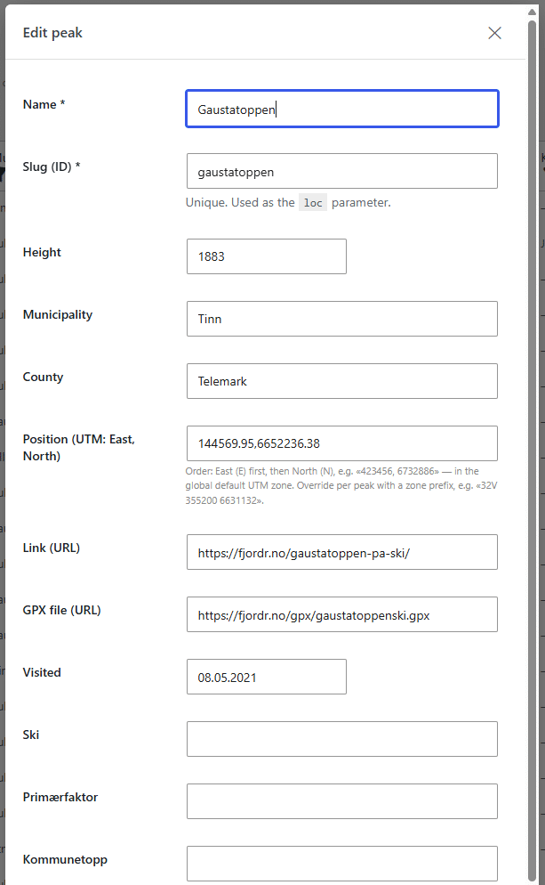
At its core, PeakMaps gives you a self-contained location database built specifically for hiking and outdoor content. Add peaks one at a time through a clean admin screen, and PeakMaps takes care of the rest: rendering them on interactive Leaflet maps, generating a sortable/filterable table, calculating elevation profiles from GPX tracks, and letting visitors search and filter — all without a single line of code.
Add it to your site in two ways:
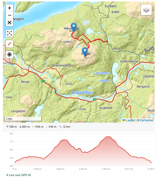
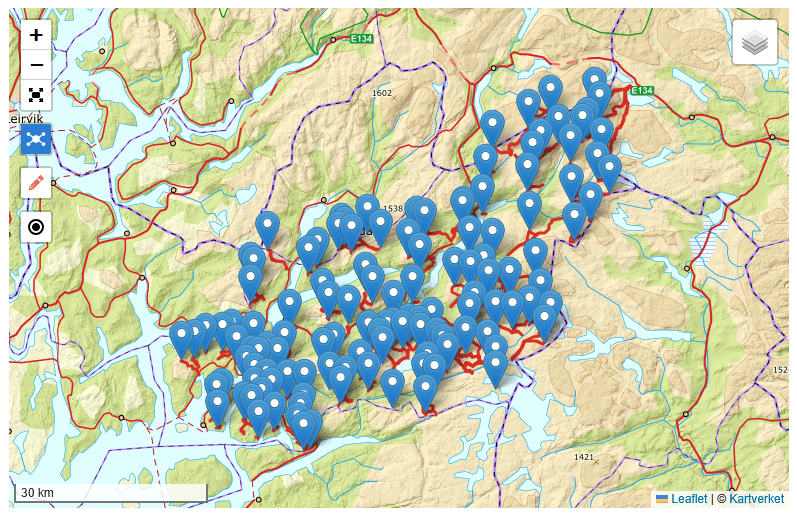
- A map block/shortcode — an interactive map showing your peaks, with clustering, GPX tracks, and elevation profiles.
- A table block/shortcode — a searchable, sortable data table of your peaks, perfect for browsable directories and overview pages.
Both can be placed anywhere, as many times as you like, each with its own filters and settings.
Requires WordPress 6.2 or later and PHP 7.4 or later.
Free, Unconditionally
Unlike many WordPress plugins, PeakMaps’ free version isn’t a limited trial. There’s no peak-count cap, no expiring features, and no nagging upgrade popups. Everything in the “Free” column below is yours, forever, on unlimited sites.
PeakMaps Pro is a separate plugin for sites that want to go further — Norwegian Kartverket maps, extra data fields, on-map tools, and a few other conveniences described below. It requires the free PeakMaps plugin to be installed, and is activated with a licence key tied to your domain. A Pro licence covers updates and email support for its term; the features themselves keep working whether or not it is renewed. See What Happens When a Pro Licence Expires below.
Free vs. Pro — Full Comparison
| Feature | Free | Pro |
|---|---|---|
| Peak database | ||
| Number of peaks | Unlimited | Unlimited |
| Add/edit peaks via admin | ✅ | ✅ |
| Bulk actions (delete, copy, set municipality/county) | ✅ | ✅ |
| CSV import (bulk insert & update) | ❌ | ✅ |
| CSV export of the peak table | ❌ | ✅ |
Five custom extra fields, with your own labels. Wildcards * and ?, and a leading ! to exclude, are supported for complex filtering | ❌ | ✅ |
| Map | ||
| Interactive Leaflet map with clustering | ✅ | ✅ |
| Fullscreen mode | ✅ | ✅ |
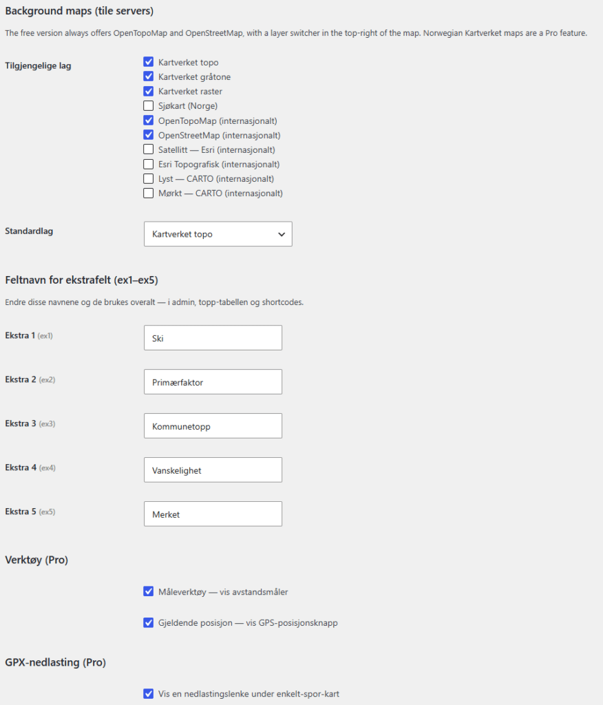
| Background layers: OpenStreetMap, OpenTopoMap | ✅ | ✅ |
| Norwegian topographic, raster & nautical maps (Kartverket) | ❌ | ✅ |
| Marker style | Standard green pin only | Choice of shape/colour, or your own uploaded image |
| Distance-measuring tool | ❌ | ✅ |
| “Find my position” GPS button | ❌ | ✅ |
| GPX tracks & elevation | ||
| GPX track shown on the map | ✅ | ✅ |
| Elevation profile chart | ✅ | ✅ |
| Elevation calibrated against Kartverket’s terrain model (only relevant when using Kartverket layers) | ❌ | ✅ |
| GPX file download link, with optional terms dialog | ❌ | ✅ |
| Table | ||
| Sortable, searchable, filterable peak table | ✅ | ✅ |
| Pagination, row numbers, column selection | ✅ | ✅ |
| General | ||
| Gutenberg blocks & shortcodes | ✅ | ✅ |
| Norwegian Bokmål translation included | ✅ | ✅ |
| On-map credit | Optional — opt-in, off by default | Optional while the licence is active |
| Automatic cache-clearing on settings change | ✅ | ✅ |
| Licence & support | ||
| Automatic updates | ✅ | ✅ while the licence is active |
| Support by email | ❌ | ✅ while the licence is active |
| Support in user forum | ✅ | ✅ |
Existing peaks, tracks, and settings are never affected by whether Pro is installed or licensed. Pro only adds capability on top of a fully working free plugin — it never takes anything away, and that stays true if a licence lapses.
What Happens When a Pro Licence Expires
Nothing stops working. Every Pro feature keeps running exactly as it did the day before: Kartverket layers stay available, your chosen marker style stays in place, your five custom fields stay editable, the on-map tools stay switched on, GPX downloads keep working, and CSV import and export are unaffected. No setting is reset, no stored data becomes unreadable, and no map or table on your site changes what it shows.
This is deliberate. A plugin that switches features off when a licence lapses turns a billing lapse into a broken website, often on pages the site owner isn’t watching. PeakMaps Pro doesn’t do that.
Two things do change:
- Maps show a small “Maps by PeakMaps” credit. It appears while the licence is not valid and cannot be switched off. Renewing the licence removes it.
- Updates and email support stop. WordPress will still tell you when a new version is available, but installing it requires a valid licence. The version already on your site keeps running, with every feature intact.
So an expired licence never leaves you with a broken site. It leaves you with the version you paid for, plus a credit line on your maps, for as long as you choose not to renew — and renewing puts everything back to normal, including any updates released in the meantime.
Key Features (Free)
🗺️ Interactive Mapping
- Built on Leaflet, the industry-standard open-source mapping library — fast, lightweight, and mobile-friendly.
- Marker clustering automatically groups nearby peaks at lower zoom levels and separates them as you zoom in, keeping busy maps clean and readable.
- OpenStreetMap and OpenTopoMap background layers, with an easy switcher for visitors.
- Fullscreen mode for an immersive, distraction-free map view.
- Smooth touch and pinch-zoom handling on mobile devices.
🏔️ GPX Tracks & Elevation Profiles
- Attach a GPX track to any peak and PeakMaps will render it on the map automatically.
- Automatic elevation profile charts, drawn on HTML5 Canvas, with interactive hover tooltips showing elevation and distance at any point along the track — appears instantly using the GPX file’s own elevation data.
- Ascent/descent totals, min/max elevation, and total distance calculated automatically.
- Secure, built-in GPX proxy — tracks hosted on any domain load smoothly in the browser without CORS issues.
📊 Smart, Filterable Data Table
- A fully sortable, searchable table of your peaks — sort by name, elevation, municipality, county, visited date, and more.
- Live filtering by municipality, county, elevation range, free-text search, and visited status — no page reload required.
- Pagination with a configurable number of results per page.
- Optional row-number column for numbered lists.
- Choose exactly which columns to display, per map or table instance.
🗄️ Your Own Peak Database
- A dedicated, purpose-built database — not repurposed WordPress posts — for fast, clean querying at any scale, with no upper limit.
- Visited/completed tracking with flexible date formats, so it doubles as a personal or club peak-bagging log.
- Show/hide individual peaks without deleting their data — great for unpublished drafts or seasonal closures.
- Full admin interface: search, filter, sort, bulk-edit, bulk-delete, and duplicate entries directly from the WordPress dashboard.
🌍 Built for Real-World Use
- Works via Gutenberg blocks (with a live, dynamic editor preview) or classic shortcodes (
[peakmaps_map],[peakmaps_table]) — drop it into any post, page, or template. - Multilingual out of the box: English source strings with a complete Norwegian Bokmål translation included, and standard WordPress i18n support for adding more languages.
- Automatic page-cache clearing on settings changes, with support for major caching plugins (WP Rocket, W3 Total Cache, WP Super Cache, LiteSpeed Cache, WP-Optimize).
- Lightweight and fast: assets only load on pages that actually contain a map or table.
What PeakMaps Pro Adds
🇳🇴 Norwegian Kartverket Maps
Switch on Norway’s official topographic map, raster map, and nautical chart as additional background layers — alongside the free international ones. When a map uses a Kartverket layer, Pro also refines the elevation profile against Kartverket’s own terrain model for extra accuracy.
🎨 Marker Styles & Custom Images
Choose from circular, square, triangular, diamond, or star markers in your track’s colour, a palette of solid-colour pins, or upload your own custom marker image entirely.
📝 Five Custom Fields
Add up to five extra fields to every peak, with labels you choose — difficulty rating, trailhead parking notes, permit requirements, or anything else your project needs. Usable in the admin, the table, and shortcode filters.
Filtering on these fields goes well beyond a plain text match:
- Wildcards —
*matches any number of characters,?matches exactly one.ex1="Fjell*"finds anything starting with “Fjell”;s??amatches “seta”, “soma”, or any four-letter word starting with s and ending with a. - Exclusion — prefix a value with
!to filter out matches instead of finding them, e.g.ex2="!closed"shows everything except entries marked “closed”. - Numeric comparisons — for fields that hold numbers, use
>,<,>=, or<=directly in the filter, e.g.ex3=">1000"orex3="<=500", with either a comma or a period as the decimal mark.
No wildcard or operator at all just falls back to a simple “contains” search, so casual use stays as easy as typing a word.
🛠️ On-Map Tools
A distance-measuring tool for trail segments, and a “find my position” GPS button for visitors browsing on mobile while out on the trail.
⬇️ GPX Download
Let visitors download the GPX file for a track, with an optional terms/consent dialog first (e.g. “for personal use only”).
📥 CSV Import & Export
Bulk-load or update peaks from a spreadsheet, with both insert mode (add new entries) and update mode (fill in missing fields or overwrite existing ones on matching entries) — perfect for loading a whole region’s worth of peaks in seconds. Columns are matched automatically from the file’s header row, and anything that can’t be imported is reported back with the line number and the reason. Export works the same way, so a full backup or a move to another site is one click each way.
Perfect For
- Hiking and outdoor blogs documenting summits, trails, and viewpoints
- Tourism boards and destination sites showcasing regional attractions
- Hiking clubs and associations maintaining a shared, browsable peak list
- Guidebook and trail-guide publishers presenting curated routes
- Personal peak-bagging logs for trackers working through a summit list
Norwegian sites documenting local terrain will get the most out of Pro’s Kartverket integration; everyone else has a fully capable, unlimited mapping plugin in the free version alone.
Pro licences are issued per domain. If you move a site to a new domain, get in touch and we’ll reissue the key.